
Morena · 54 km
A circular eleventh-century temple of 64 yogini shrines on a hilltop — widely said to be the model for the Indian Parliament building.
 © Jain cloud · CC BY-SA 3.0
Hero photograph by Jain cloud (CC BY-SA 3.0) · source. Remaining gallery slots await licensed imagery.
Datia district, Madhya Pradesh
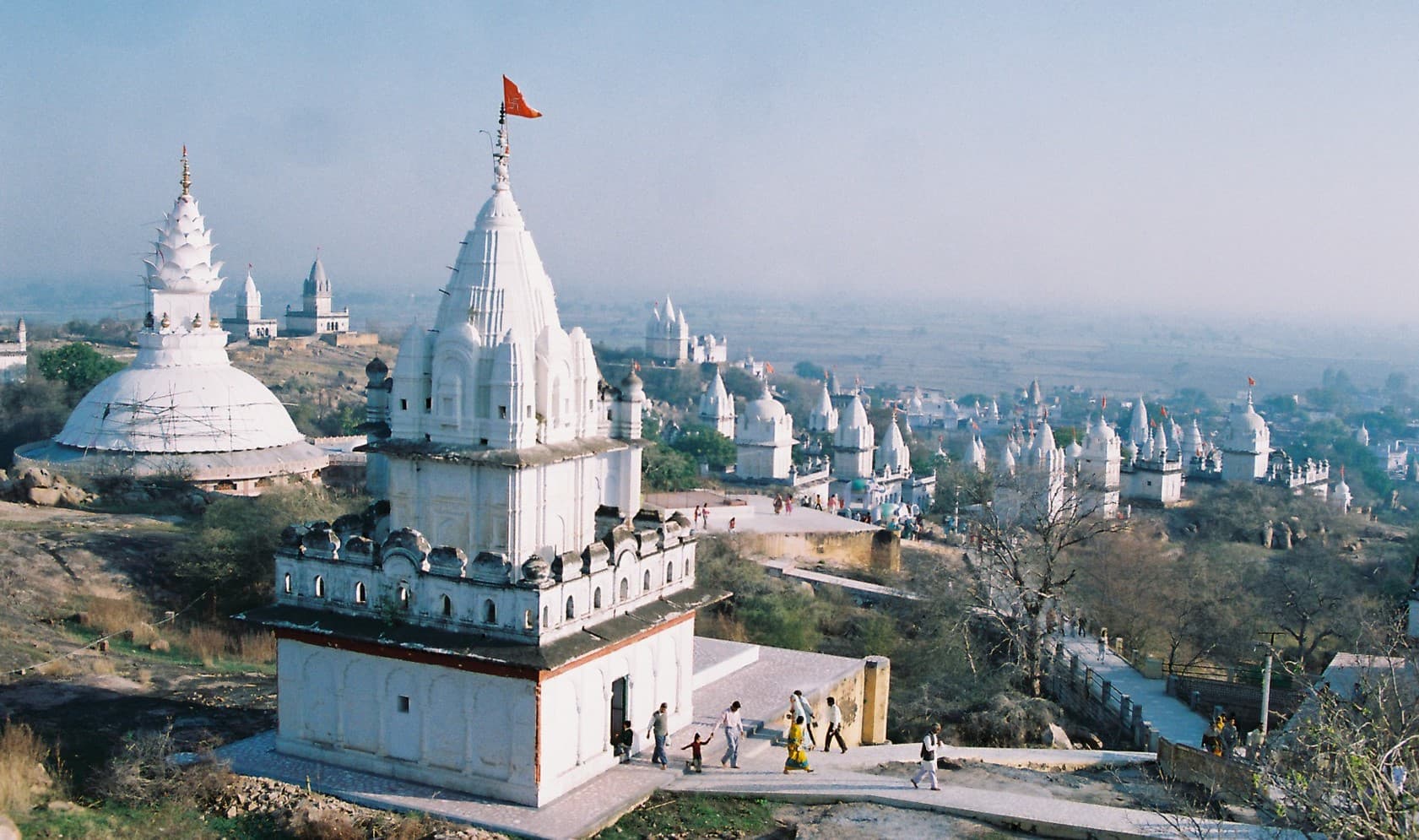
A hillside of white shikharas against the sky, with almost no visitors, and a rule of silence on the climb that makes it one of the most peaceful places in north India.
Sonagiri is a Digambara Jain siddha kshetra — a place of liberation — and tradition holds that Nanganang Kumar and five and a half crore ascetics attained moksha here. Most of the 77 hilltop temples date from the seventeenth and eighteenth centuries, though the site is far older; the principal temple, number 57, holds an 11 ft image of Chandraprabhu, the eighth Tirthankara. Another 26 temples sit in the village below. Pilgrims climb barefoot, and the hill is kept in silence. The whitewashing is renewed communally every year.
5 things · 4 hr 55 min to do all of them
Single day · 4 hr 55 min of planned activity
Base temples and manastambha pillars
40 min
Barefoot climb to the hilltop
45 min
Temple 57 and the principal cluster
45 min
Full circuit of the hilltop temples
1 hr 15 min
Descend; village temple cluster
45 min
Drive on to Datia Palace
45 min
15 km — a seven-storey Bundela palace, also almost empty
The shaded ring is the check-in geofence — 600 m around the site. Your GPS has to fall inside it for a check-in to count.
25.7000, 78.4000 · Open turn-by-turn in Google Maps
Sonagiri has its own small railway station on the Delhi–Bhopal line, 2 km from the base. Datia is 15 km, Gwalior airport 60 km. Buses from Datia and Gwalior.
Last mile: Autos from Sonagiri station to the hill base are ₹50. Then it is on foot, barefoot.
A barefoot climb of roughly 300 steps. Doli (palanquin) carriers are available at the base.
4.7from 190 explorers
Only explorers with a verified check-in here can leave a review.
Preeti Yadav
@niwari_notes · 7 Jun 2026
Monsoon visit. Everything was green and the water was full, but the steps were lethal and I nearly went over twice. Stunning, and I would not bring children.
Tip: Monsoon is the best and the most dangerous time. Proper shoes.
20 found this helpful
Devendra Singh
@fortfinder · 5 Jun 2026
Monsoon visit. Everything was green and the water was full, but the steps were lethal and I nearly went over twice. Stunning, and I would not bring children.
Tip: Monsoon is the best and the most dangerous time. Proper shoes.
8 found this helpful
Ordered by tier before distance — the least-visited neighbours come first. This list is the redistribution engine.
Morena · 54 km
A circular eleventh-century temple of 64 yogini shrines on a hilltop — widely said to be the model for the Indian Parliament building.

Morena · 71 km
Around 200 small eighth-century temples rebuilt stone by stone from rubble, in Chambal ravine country, by an archaeologist who negotiated with dacoits to do it.
Niwari · 79 km
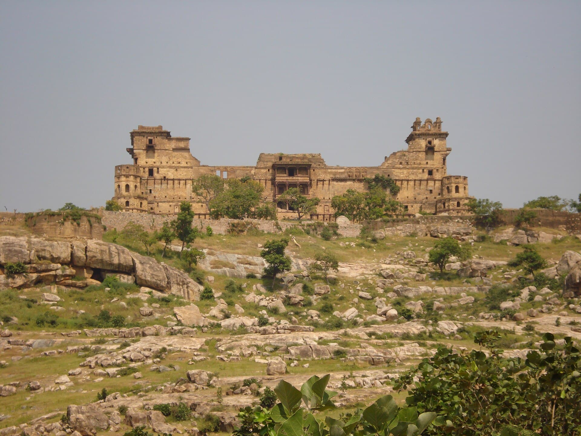
A hill fort of the Khangar kings that is invisible until you are almost on top of it — and reportedly has an underground level nobody has fully mapped.

Niwari · 46 km
A Bundela capital frozen in the sixteenth century — palaces, riverside cenotaphs and a temple where Rama is worshipped as a reigning king.

Gwalior · 63 km
A hill fort Babur called the pearl among Indian fortresses — three kilometres of sandstone wall, a tiled palace, and the second-oldest written zero in the world.